
As you can see the 48 hour forecast map above and the real time weather map to the right are very similar. An occluded front which is where a cold front overtakes a warm front is along the coasts of Oregon and Washington. A warm front is approaching the coast of California and as you can see through the Infared image below the clouds is beginning to clear out along the coastline. Right behind it however you can see the cold front where the cloud formations are and precipitation is prevalent. The temperatures along the coast of California, as shown below, illustrate a range between 68 and 86 degrees. In contrast on the other side of the Sierra mountain range where I would assume the warm front will get caught up in time for the cold front to catch up, the temperatures are 46 to 61 degrees. | 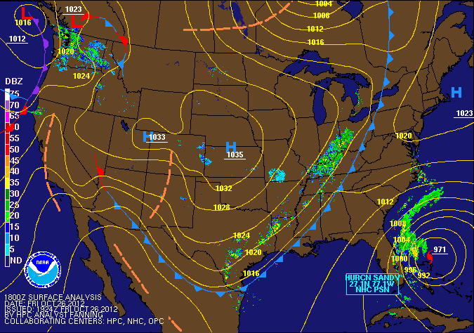 |
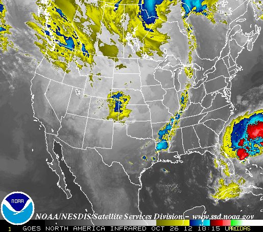 Along the Washington and Oregon coastline you can see through the Infrared image that there is more cloud coverage and precipitation. This is of course the case for the occluded front that is hitting this area right now. The temperatures range from 60 to 54 degrees as the graph shows. It seems as though this is a warm-type occluded front since the air it is overtaking is cooler than the front itself. This will cause showers and overcast skies. If you open the document labeled “Current conditions and forecast” you will see that there are currently showers and overcast skies in Seattle, WA. This falls in line with the occluded front characteristics. |  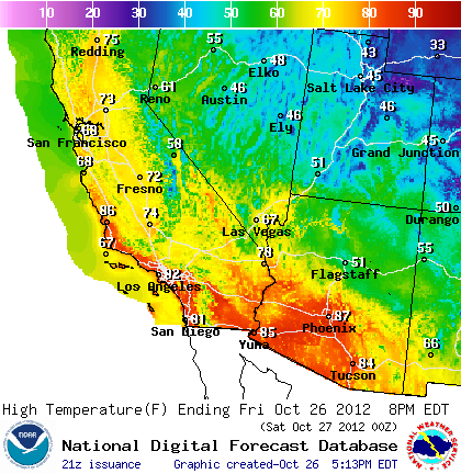 |
Reflection
This assignment has helped me comprehend the differences found within each type of front. To include weather that will come with a front moving in. This will also help me when watching the forecast on the news to understand for myself what the conditions will be like in the next few days from charts that they show.